A Boater's Guide to Living in Vero Beach
October 9, 2025
October 9, 2025
Salt air mornings, glassy lagoon afternoons, and ocean runs when the forecast lines up. Living in Vero Beach puts you on the Indian River Lagoon with quick access to the Atlantic and a year-round boating rhythm. This guide gives you the on‑water facts, local rules, storage options, and homebuying tips to make boat-centric living smooth from day one.
Sheltered waters meet bluewater opportunity here. The Indian River Lagoon is part of the Intracoastal Waterway, so you can cruise in protected water most days, then pick your weather window for offshore fishing or a run to the Bahamas. The city’s municipal marina, public ramps, and service network make boating practical whether you keep a skiff, a center console, or a cruising sailboat according to the City of Vero Beach Marina.
Daily life is simple: morning paddle or flats mission in the lagoon, lunch on the island, sunset raft-up behind a spoil island, and back at your dock before dark. When you want the ocean, Sebastian Inlet is the usual gateway for Vero-area boaters as described by the city marina.
Vero Beach sits on a broad stretch of the Indian River Lagoon that doubles as the ICW. You get miles of protected routes for cruising, sailing, or fishing. For open ocean, most boaters run south to Sebastian Inlet or north or south to other inlets depending on weather and trip plans per the city marina overview. Channels can shoal and markers can move, so check chart updates and Local Notices to Mariners before you go. The U.S. Army Corps and partners schedule maintenance dredging, which can affect depths and buoy placement along the corridor as noted by the U.S. Army Corps of Engineers.
Two fixed bridges span the lagoon at Vero Beach. The SR‑60 Merrill P. Barber Bridge and the 17th Street Bridge are commonly cited in the low to mid 60 feet of vertical clearance, which works for many masts below that height. Always verify real-time height and tide before committing to a passage see the Merrill P. Barber Bridge reference. Tidal range inside the lagoon is modest, often around a foot, but wind-driven water can change effective depths. Use current tide stations and forecasts to plan safe draft windows via NOAA tide benchmarks.
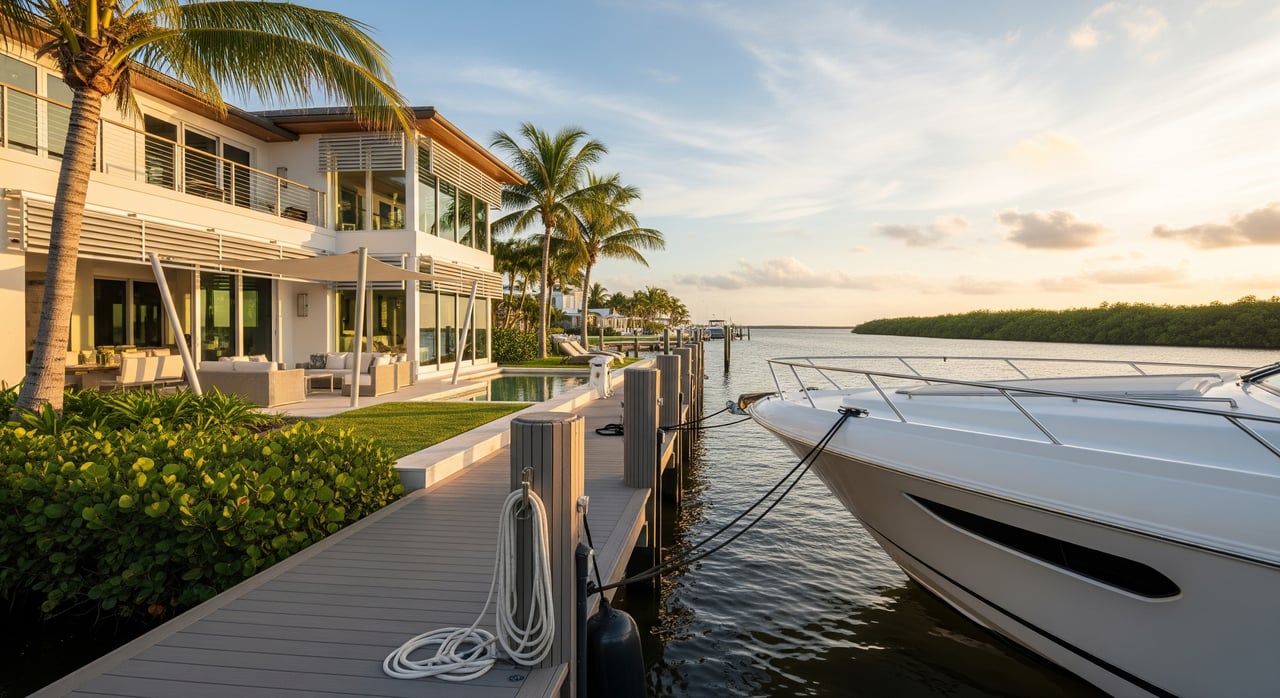
The City of Vero Beach Municipal Marina offers transient and long‑term slips, rental moorings, fuel, pump‑out, showers, Wi‑Fi, and a harbormaster team. Long‑term slips often use a waitlist, so inquire early for annual plans and storm season policies per the marina. Private marinas and yacht facilities add more options. Many guides list approach depths near 8 to 10 feet at the city fuel dock, but verify depths and hours directly before arrival see Waterway Guide’s listing.
Most marinas publish transient, monthly, and seasonal rates, plus electric tiers. The city also posts a storm and hurricane policy. Always confirm current pricing, waitlist terms, and cancellation rules before you commit see Reservations and Rates.
Dry storage keeps your hull out of saltwater, limits fouling, and simplifies storm prep. Ask about max boat height and length, launch windows, fuel policies, and weekend queue times. Boatyards provide haul‑out, bottom paint, and major service. In the Vero area, you will find mobile mechanics and shops that handle engines, electrical, and rigging, with larger refit yards available along the Treasure Coast example local service hub.
Fuel docks in Vero offer gasoline and diesel. Prices and supply change often, so call ahead. The city marina provides pump‑out, which is extra important now that the lagoon section south of Vero is an NDZ. Florida’s Clean Vessel Act and tools such as Pumpout Nav can help you locate services and understand NDZ rules Florida Sea Grant’s sewage solutions overview. Plan routine service intervals for engines and generators, and schedule bottom work before peak season to avoid yard delays.
Indian River County maintains multiple public ramps with courtesy docks and parking. Popular options near Vero include riverside parks and access points, while Sebastian Inlet State Park offers a large launch complex and ocean access. Check county park details for hours and any fees via Indian River County Parks and review inlet navigation notes through regional authorities Sebastian Inlet navigation.
Neighborhoods and HOAs often regulate street parking, trailers, and outdoor storage. If you own a trailered boat, confirm neighborhood rules and consider off‑site storage to keep the driveway tidy and in compliance.
Evaluate structure, pilings, cap condition, and utilities. Match lift capacity to your heaviest loadout. In saltwater, aluminum and composite materials hold up well with proper isolation and bonding. Ask about past permits and timelines for new work. Some areas may require environmental review to protect seagrasses and shoreline habitat, which are a focus of county restoration programs see seagrass restoration projects.
Common rules include boat length and height limits, trailer bans, quiet hours, and dock lighting standards. Insurance planning should address wind and flood, dock and lift coverage, and named-storm deductibles. If your marina or HOA has a hurricane policy, align your plan with their requirements.
A 5 to 15 minute run to favorite sandbars or the fuel dock keeps spontaneous trips easy. For offshore anglers, measure home-to-inlet time and add a safety buffer for bridge no-wake zones and weekend traffic.
Salt is relentless. Build a simple routine: freshwater rinse after every trip, flush engines, wax metals, and keep up with sacrificial anodes. Schedule bottom paint based on use and water conditions, and log annual service for engines and gensets. Keeping a maintenance calendar avoids midseason surprises.
The Atlantic hurricane season runs June 1 through November 30, so set a plan well before summer per NOAA. The city marina posts a storm policy that limits last‑minute slip guarantees, so book early and know your haul‑out options see marina rates and policies. Many insurers and marine groups recommend a written checklist that covers stripping canvas, doubling lines, chafe gear, fendering, photos for records, and haul‑out reservations when possible hurricane best practices.
If you split time, choose storage that matches your season. Dry stack or a monitored slip with a local caretaker can keep systems fresh. Align annual service with your arrival, and schedule bottom work and yard time for your off months.
A waterfront purchase is about more than a pretty view. A boating‑savvy team will:
Thinking about selling a boater‑friendly home or seeking one that fits your vessel and routine? Get a data‑driven sense of value and timing, then tour neighborhoods that match your on‑water goals. When you are ready, partner with Vero Premier Properties for concierge‑level guidance from search to closing.

Lead Real Estate Agent
Buying a home is a very emotional experience, especially for those who have not done it very often. My experience in sales can help guide buyers with an analytical approach.
Find Your Dream Home
Get assistance in determining current property value, crafting a competitive offer, writing and negotiating a contract, and much more. Contact us today.